
Interactive US Map – WordPress Plugin
$4.99 Free for Members
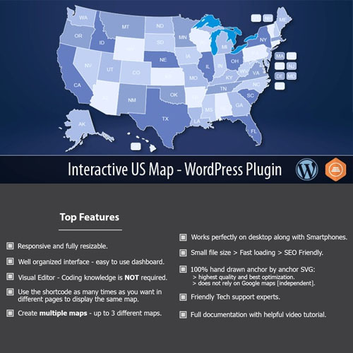
A WordPress plugin that shows a clickable map of the United States. Each state can link to a custom URL, show a tooltip, or carry its own color.
| Version | 2.7 |
|---|---|
| Last Updated | May 21, 2023 |
| Type | WordPress Plugin |
| License | GPL v2 or later |
| Live Demo | View demo → |
100% GPL · Original files · Unlimited sites
- Original, unmodified files — delivered exactly as distributed by the developer
- GPL licensed — use it on unlimited websites, personal or client
- Free updates — new versions appear here as soon as they are released
- Verified downloads — every file is integrity-checked (SHA-256) before release
Distributed under the GNU General Public License. Not affiliated with the original developer; official support, license keys and developer-hosted services (such as one-click updates) are available only from the developer.
Secure checkout with PayPal · GPL licensed · Instant download
Description
This WordPress plugin displays an interactive map of the United States on your site. Every state on the map can be clicked, and you can point each one to a URL of your choice. States can also show tooltips with information and be color-coded, which supports data visualization or location-based navigation.
Key Features
- Clickable US map – The plugin renders a map of the United States whose states visitors can click.
- Custom state links – You can send each state to a URL you choose, so clicks lead wherever you need.
- State tooltips – Hovering or interacting with a state can reveal a tooltip containing information you provide.
- Color-coded states – States can be given different colors, which helps when presenting data or guiding navigation by location.
Who Is It For
This plugin suits WordPress site owners who need a map-based way to present or navigate US locations, such as organizations arranging state-by-state links or anyone visualizing regional data on a page.