
Interactive World Maps
$4.99 Free for Members
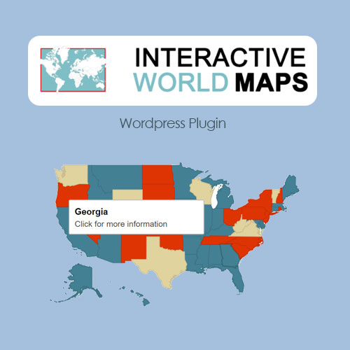
Interactive World Maps is a WordPress plugin that creates clickable SVG maps. It displays world, continent, and country maps with color-coded regions, tooltips, clickable links, and responsive design.
| Version | 2.5 |
|---|---|
| Last Updated | April 24, 2024 |
| Type | WordPress Plugin |
| License | GPL v2 or later |
| Live Demo | View demo → |
100% GPL · Original files · Unlimited sites
- Original, unmodified files — delivered exactly as distributed by the developer
- GPL licensed — use it on unlimited websites, personal or client
- Free updates — new versions appear here as soon as they are released
- Verified downloads — every file is integrity-checked (SHA-256) before release
Distributed under the GNU General Public License. Not affiliated with the original developer; official support, license keys and developer-hosted services (such as one-click updates) are available only from the developer.
Secure checkout with PayPal · GPL licensed · Instant download
Description
Interactive World Maps is a WordPress plugin for building clickable SVG maps. You can show world maps, continent maps, and country maps, with regions colored by category and tooltips on hover. The maps support clickable links and adapt to different screen sizes, which suits geographic data visualization.
Key Features
- Clickable SVG maps – The plugin builds maps as SVG graphics that visitors can click on.
- World and continent maps – You can display maps of the world as well as individual continents.
- Country maps – Country-level maps are available alongside the world and continent views.
- Color-coded regions – Regions on a map can be colored to distinguish them from one another.
- Tooltips – Hovering over a region shows a tooltip with its information.
- Clickable links – Regions can carry links that take visitors to another page when clicked.
- Responsive design – The maps resize to fit the screen they are viewed on.
- Geographic data visualization – The maps are intended for presenting geographic data visually.
Who Is It For
This plugin is for WordPress site owners who want to present geographic information on a map, such as organizations, publishers, or businesses showing locations, regions, or coverage areas. It fits projects that need world, continent, or country maps with clickable, color-coded regions.